Making the Illustrated Map of London History and Culture, my latest piece, has been, by far, the most challenging work I have completed to date. The map took me 11 months from start to finish. In that time we endured the freezing 'Beast from the East', celebrated a Royal wedding, had a glorious heatwave (known as summer in most countries) and football very nearly came home. I also got engaged and moved house. A lot can happen in one year.
RESEARCH AND PREPARATION
I have drawn several maps of London already, but I wanted to create something that really captured some of London's rich history and culture. I have always been a massive history nerd and love discovering new facts and trivia about a place. The research process for this map was very intense and laborious. I read extensively, scoured online articles, listened to London-related podcasts and music, watched many London films, trekked around searching for blue plaques and new bits of trivia and then had to cross check all of the information and dates.
DRAWING AND CORRECTION
The drawing was very labour intensive and challenging, as it was so large. I had to come up with very inventive and resourceful drawing positions. I like to draw everything by hand using fineliner pens. Having completed the drawing, I then had my work scanned and began the extremely lengthy and arduous process of photoshopping and correcting blurred lines, smudges, pencil marks, rewriting words and fixing spelling mistakes, etc. This process took 3 months and was probably the hardest part of creating the piece, as it was so tedious and was during the glorious heat wave. It was also not helped by the fact I am dyslexic and terrible at spelling. I would like to take this opportunity to thank everyone for their podcast recommendations, without which I may have gone insane.
THE FUN BIT... COLOURING IN
After what seemed like an eternity of photoshopping, I was ready to have my map proofread (multiple times) and then get it printed ready for me to start colouring. The colouring was the part of the process I enjoyed the most. It was so therapeutic and creative compared to the computer correcting work. I wanted to create a colour palette that was more pastel-based then my last piece. The work of David Hockney, as well as photos of 1950s Las Vegas, inspired me in my colour choices.
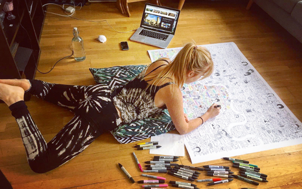
I like to colour by hand using Promarker and fineliner pens. I prefer to use this tactile physical method, rather then add colour on the computer. Plus, I am such a pen geek and genuinely got excited when I got to go and buy new colours and styles. Due to the large size of the map (it is almost A0 in size), I had to abandon the table and opt for colouring on the floor. The last section of the map I coloured in was the Thames. For some reason I always do this. Once the image was scanned in again, I had it proofread several times more (big thanks to my wonderful family and friends) and then I was finally ready to get it printed.
A LEARNING EXPERIENCE
Although the process was lengthy and definitely challenging, I feel like I have learnt so much about the city that I have spent my entire life in and thought I knew so well. I have also poured in a great deal of my own experiences in London and have included references to a many of my favourite bands, films, books and places in the city. I hope others will also find something new when they look at my work.
IMAGE GALLERY
Below you will find a selection of photos taken over the past 11 months during the making of the Illustrated Map of London History and Culture. Click on the images for a larger view.


This only took you 11 months to complete? At least you had a super cute research assistant. ?